
Thanks for checking out this month’s edition of our Lens newsletter. See the highlights here and scroll on for all the details!
- 🗞️ What's new: Resources for trespassing detection and shoreline monitoring
- 👩🏫 Education: Learn how to quickly assess storm damage with Lens
- 💚 Where on Earth: From Lake Saint Clair, with love
If you missed this newsletter in your inbox, be sure to subscribe to stay up to date to the latest product updates, events, and remote monitoring resources.
What's new
Access new AI monitoring playbooks
We've released two new resources with frameworks to detect changes quickly, deploy field teams when necessary, and reduce monitoring costs & staff time by over 90%.
.png)
AI monitoring for shoreline management
Monitor shorelines with satellite imagery and agentic AI to detect unpermitted structures and compliance issues early. Access the playbook
.png)
Remote monitoring for trespass & encroachment
Learn how utilities, land agencies, and transportation operators can use satellite imagery and AI for remote trespass and encroachment monitoring. Access the playbook
🌈 Coming soon: Multispectral data ordering
Lens will now give you direct access to the raw multispectral bands that power vegetation and water monitoring, including Near-Infrared (NIR) and other spectral data beyond what the human eye can see. Keep up on LinkedIn
🛰️ New imagery source: Vantor WorldView Legion
Vantor's WorldView Legion imagery is now available in Lens! Vantor, formerly known as Maxar, has different satellite constellations that capture imagery. The WorldView Legion constellation offers imagery at 30cm resolution, and when imagery is captured for your areas it will automatically be available for ordering in the Order pane. Learn more.
Education
.png)
How to quickly assess storm damage
Check out our new blog on how Lens enables your team to identify flooding, infrastructure damage, vegetation loss, and shifting river conditions in hours instead of weeks.
Where on Earth?
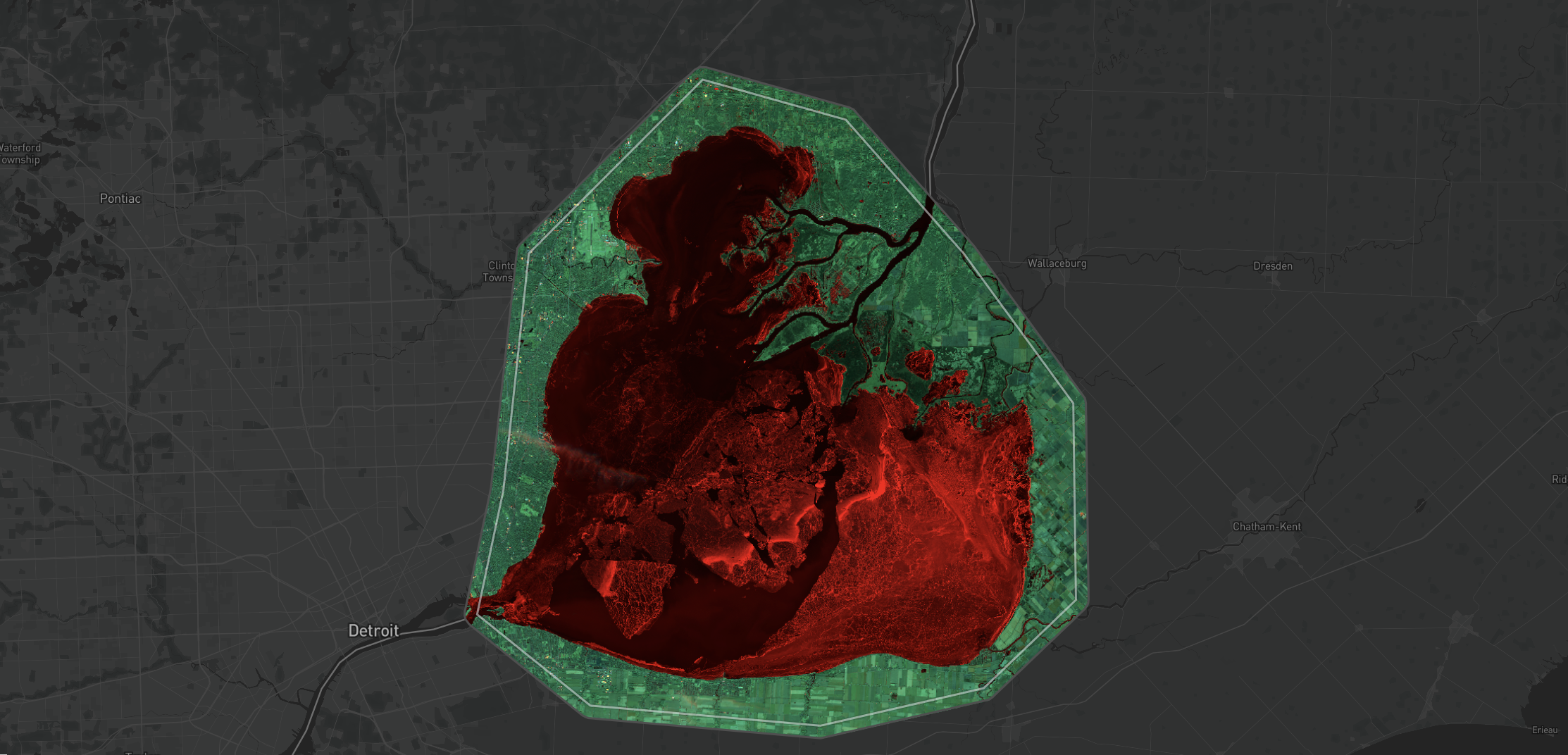
We love sending love notes with satellite imagery. ❤️ Lake Saint Clair is northeast of Detroit, Michigan and had beautiful ice cover in early January. The ice is even more striking in Blue, SWIR falsecolor imagery: ice appears as bright red, and water appears as very dark, almost black.
Stay update with the latest in Lens by heading to our Resources page, and feel free to drop us a line with any questions.
Contact
Happy monitoring!
- The Lens Team


